Meandro del Melero

Recommended, and genuinely spectacular. It costs you nothing but the drive.
The single best view in Las Hurdes, with no walking required.
At a Glance
- — You want a walk to earn the view — this one is beside the road
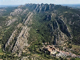
The Meandro del Melero is a horseshoe bend of the river Alagón, cut into slate and granite below the village of Riomalo de Abajo, and it is the view that sells Las Hurdes to Spaniards who have never been. There is a small marked viewpoint beside the road above the gorge, reached by car with no walking at all, looking down onto the river where it loops almost three hundred and sixty degrees around a promontory. Go in the late afternoon for the light and in spring, when the water is high and the hillside is green rather than burnt. Fifteen minutes is enough; stay longer for the drive down to the river.
How it got here
The Hurdes region existed in isolation for centuries, defined by a rugged topography that hindered communication with the rest of Extremadura. Poverty characterized the area until the twentieth century, when state intervention brought roads and infrastructure to formerly inaccessible mountain settlements. This bend in the Alagón river marks the border between the province of Cáceres and the autonomous community of Castilla y León. It serves as a visual testament to the harsh, fractured geology that historically dictated the survival of local populations, who practiced subsistence agriculture on terraced slopes carved from slate and granite before tourism reshaped the local economy.
Where it sits
The river Alagón carves a deep horseshoe through the jagged mountains of the Sierra de Francia and Las Hurdes. Slate ridges dominate the horizon, creating a stark landscape that transitions from austere greys in the dry summer to vibrant greens after spring rains. Narrow, winding roads connect the viewpoint to the valley floor near Riomalo de Abajo. While the viewpoint attracts travellers during the middle of the day, silence returns to the gorge once the sun dips behind the western peaks, revealing the stark emptiness that defines much of northern Cáceres.
What to eat and drink
Cáceres cuisine relies on the products of the dehesa and mountain pastures. Cabrito, young goat roasted in wood-fired ovens, provides the main protein of the local diet. The region produces high-quality honey and pollen, a legacy of traditional apiculture in the valley. Pimentón de la Vera, a smoked paprika made from dried peppers, flavours many stews and chorizos. Drink local wines from the Ribera del Guadiana, or sample the intense, acorn-fed jamón ibérico de bellota, which defines the culinary output of the province and draws from the vast holm oak forests covering the nearby slopes.
Extremadura: the whole region
The emptiest region in Spain, and the one where the scale of the country is clearest: dehesa plains running to the horizon in every direction, hilltop towns built from the stone under them, and the best Roman remains in the country at…
Minimum 4 days · better 7-8 days · deep 12 days

In Extremadura


In Extremadura





Logistics are verified only. We don't publish schedules we haven't confirmed.
Experiences worth booking ahead
Spain Field Guide may earn a commission when you book through selected links. Recommendations are editorial and independent of commission.
Ready to build Meandro del Melero into a trip?
You've found a place worth going. When you're ready to turn discovery into an itinerary, Travel Itinerary Co picks up where the Field Guide leaves off — with your saved places already in hand.
Build this into a tripContinues on Travel Itinerary Co
Spain Field Guide may earn a commission when you book through selected links. Recommendations are editorial and independent of commission.